
Longridge Fell map
LF_MTBO_Competition
Information
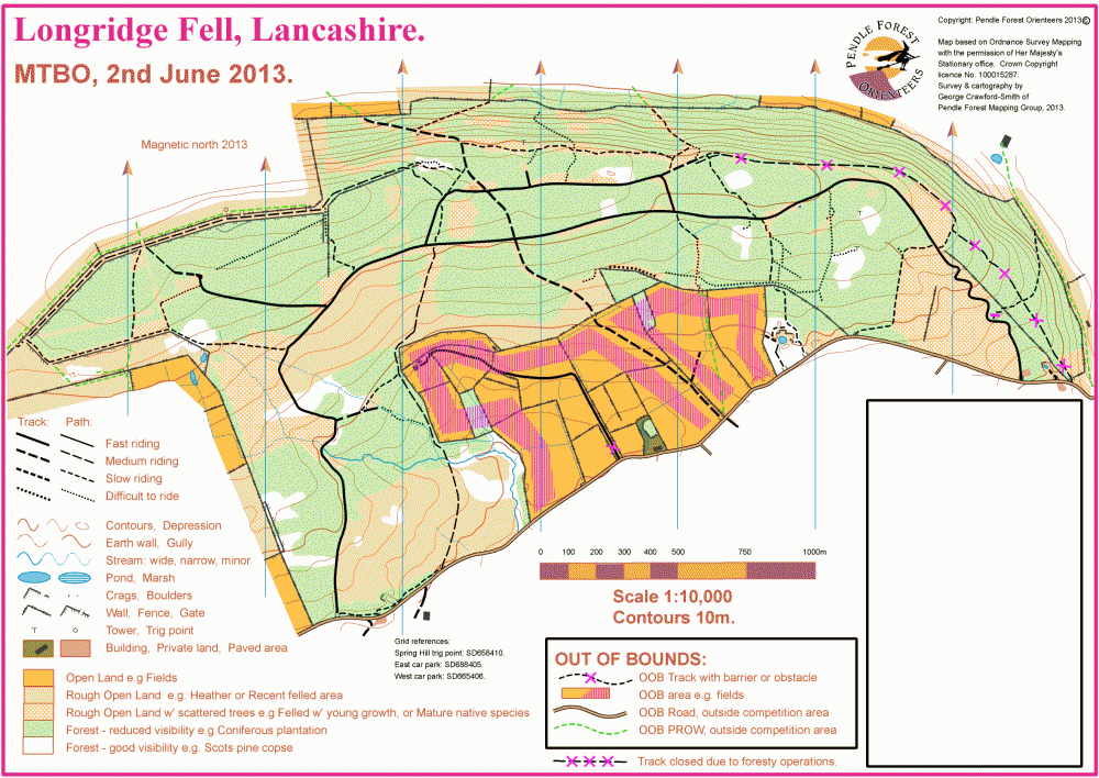
Longridge Fell MTBO Map Extract
Longridge Fell near Hurst Green, Clitheroe was mapped for MTBO competition in 2013.
The final competition map is published here. The area comprises a criss-cross network of rideable tracks and paths. Minor tracks have been created by riders and/or walkers through some of the older more open parts of the forest. These are generally shown as 'Path: difficult to ride'.
In addition to the large areas of coniferous plantation (whether standing, recently felled, or felled with young growth) there are:
- Islands of mature widely-spaced Scots Pine woodland. Such areas are shown on the map as white 'Forest: good visibility'.
- Areas of scattered trees. mostly native species. Such areas are shown on the map as 'Rough open land: scattered trees'.
Other points to note:
- The normally rideable track to the NE of the map was marked as 'closed' for the 2013 competition due to felling operations.
- A quarry appeared in the two weeks before the competition and is not marked on this map. It was dug to provide the base material for upgrading forest roads.
The competition map includes the northern and eastern escarpments. These are very steep, such that 5m contours would obscure other map detail. Therefore the whole area has been mapped using 10m contours.