
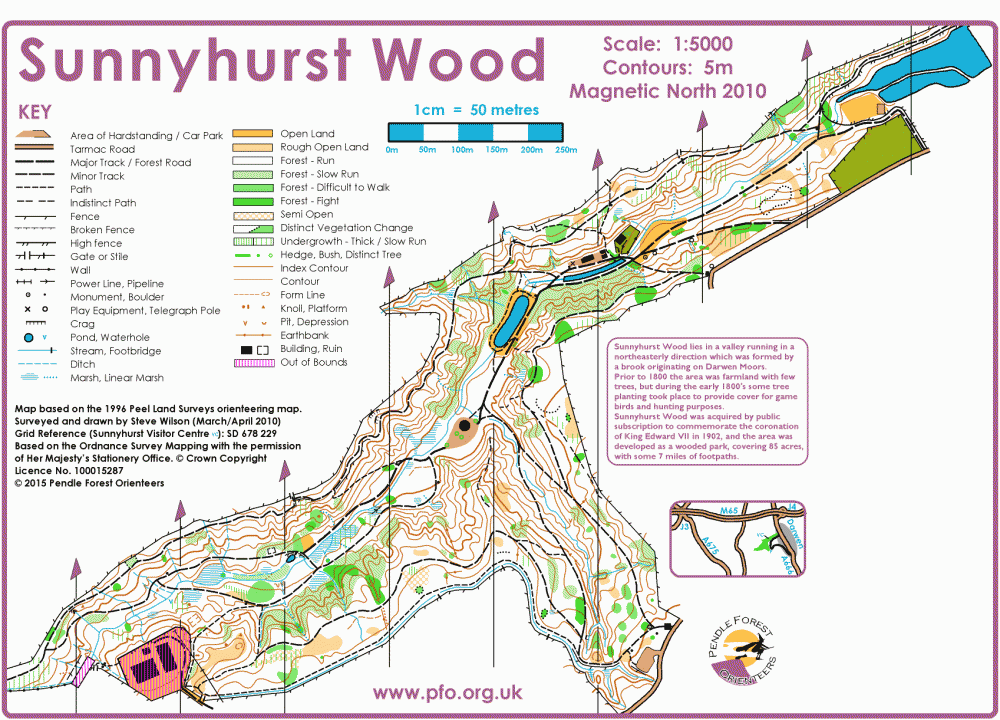
Sunnyhurst Woods map
Sunnyhurst_2015_v4
Information
Sunnyhurst Woods, Darwen
Sunnyhurst Wood lies in a valley running in a northeasterly direction which was formed by a beck originating on Darwen Moors.
Prior to 1800 the area was farmland with few trees, but during the early 1800's some tree planting took place to provide cover for game birds and hunting purposes, but was later sold to a local mill owner. Later with the decline of the cotton industry, Sunnyhurst Wood was acquired by public subscription to commemorate the coronation of King Edward VII in 1902, and the area was developed as a wooded park, covering 85 acres, with some 7 miles of footpaths.
Today the 'park' is only 10% open spaces and 90% woodland (beech, oak and other native species, plus some conifer stands), which makes it excellent for orienteering. After May, undergrowth can be thick in some parts, though other parts remain runnable all year. There are paths in the valley bottom as well as terraced tracks high on the valley sides. Steep paths and steps link the levels, though experienced orienteers will find other routes through the woodland.
The area provides both easy orienteering along the many linking paths and technical orienteering should you choose to take the direct route.