
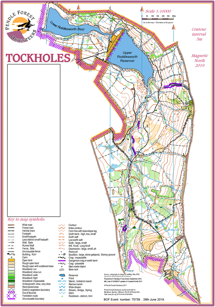
Tockholes Woods map
Tockholes 2019 v13 2019 06 02
Information
Mixed woodland reservoir catchment area. Excellent technical standard. Good runnable terrain at all times of year.
Tockholes has been used for orienteering since the very beginning of orienteering in the UK. It was voted best area in Lancashire in the recent best 100 areas in the UK listing.
95% of the competition area is woodland covering the catchment for Roddlesworth Reservoirs. A wide stream bisects the area with many tributaries and deep valleys on the steeper slopes. The area is mostly mature deciduous woodland including beech, almost all of which is fast runnable terrain with minor undergrowth at all times of year . There are also areas of coniferous plantation which are slower but passable. Some open areas and semi-open areas have seasonal growth making them slower. Old quarry workings give intricate contour detail and ruins. Rock features include some 10m high crags!
The whole area gives some of the best traditional orienteering in Lancashire. Fast, runnable and intricate.
The area is open to the public and you may encounter walkers, runners, cyclists and horse riders. Please be considerate.
Tockholes was used in October 2012 for the Lancashire HotPot weekend incorporating the UK Relay Finals and Middle Distance event.
There is a Permanent Orienteering Course at Tockholes, the maps are available from Vaughn's café and information centre in Tockholes village.