| Map name | Near | Info | Map |
|---|---|---|---|
| Aitken Wood | Barley village, Nr Pendle Hill | Aitken Wood & moorland, Barley |

|
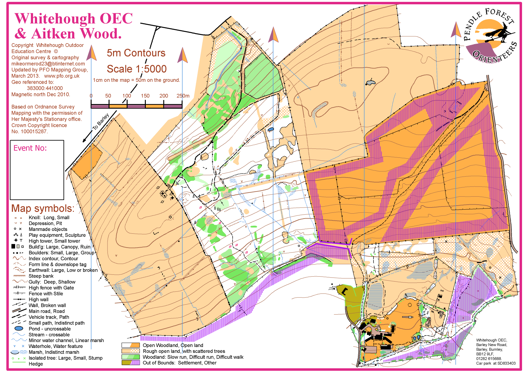
| Aitken Wood & Whitehough OEC | Nelson | Aitken Woods and Whitehough Outdoor Education Centre |
|
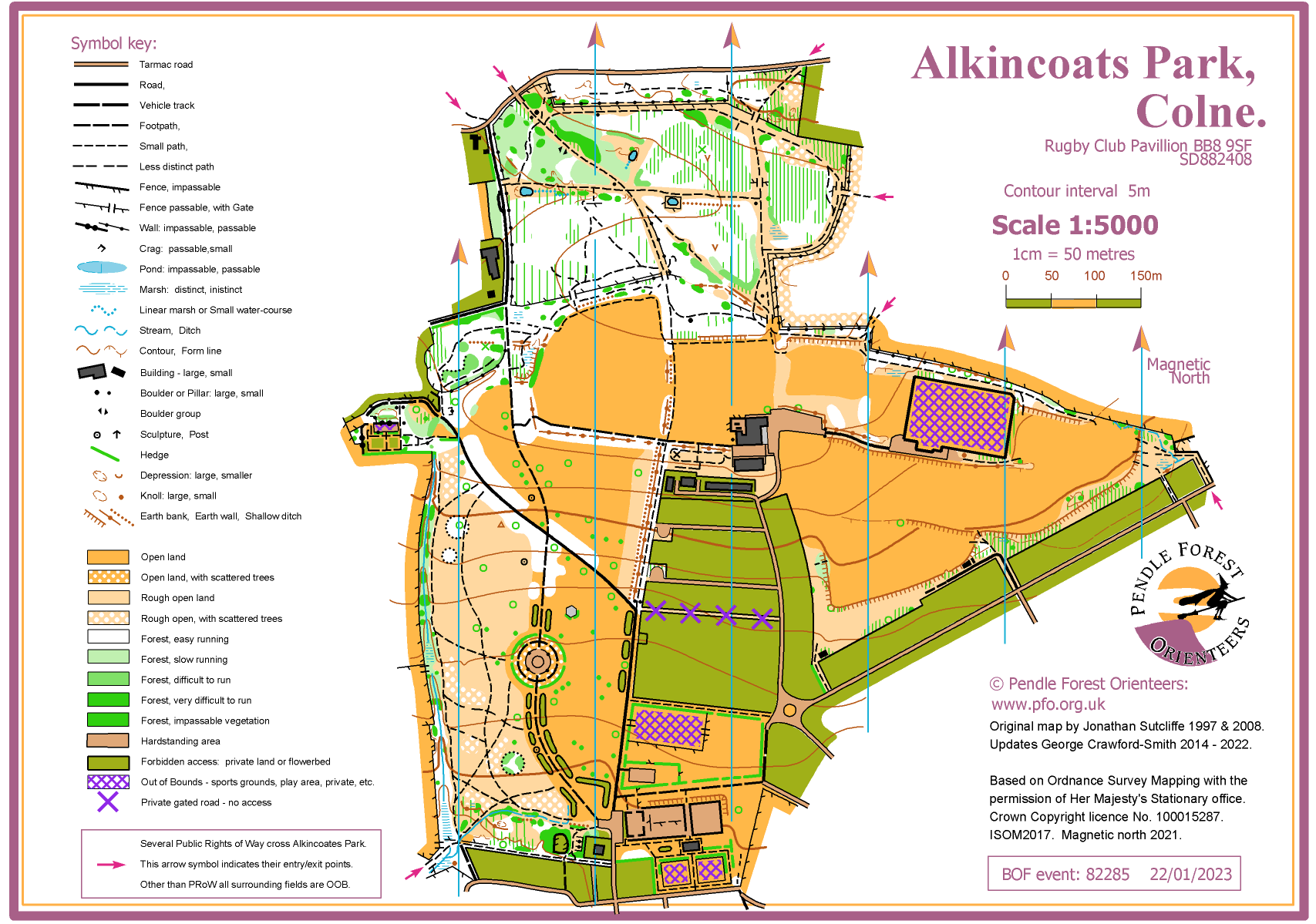
| Alkincoats Park | Colne | Alkincoats was once an estate owned by the de Alkincoats family, which in 1570 comprised several estates. |
|
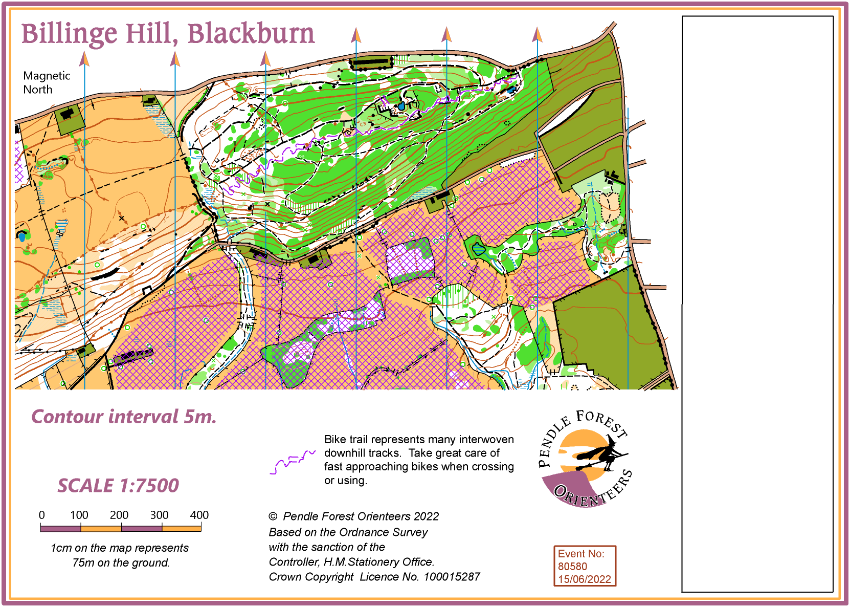
| Billinge Hill, Blackburn | Billinge Hill is the northern part of the Witton Park. |
|
|
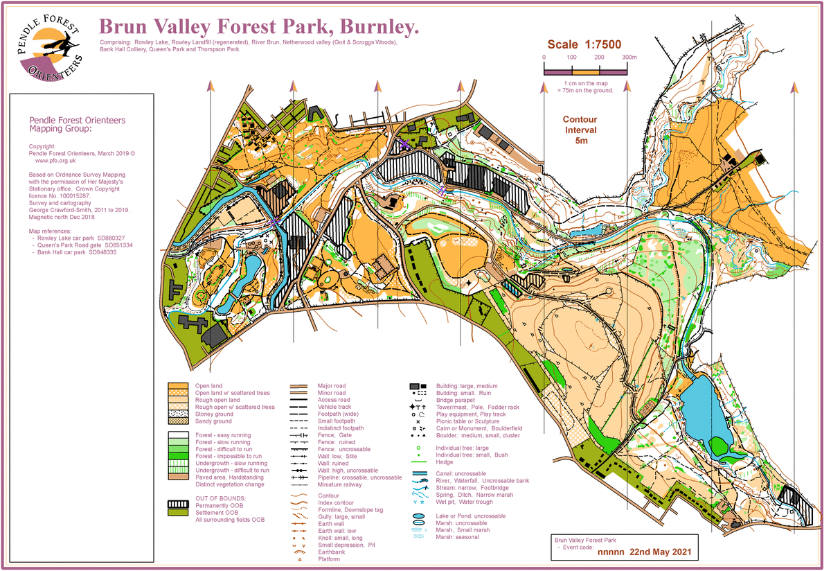
| Brun Valley Forest Park | A large area of linked forest and open land. |
|
|
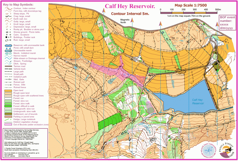
| Calf Hey | Haslingden | Calf Hey is a typical Lancastrian water catchment area with a mix of grazing land, forest and rough open moorland. |
|
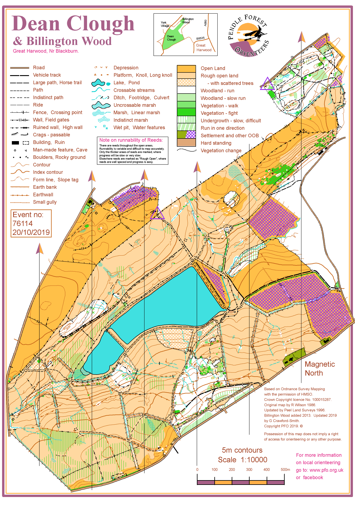
| Dean Clough | Great Harwood, | Dean Clough is the water catchment area for two reservoirs west of Great Harwood. |
|
| Gawthorpe Hall | Padiham | Gawthorpe Hall - National Trust |

|
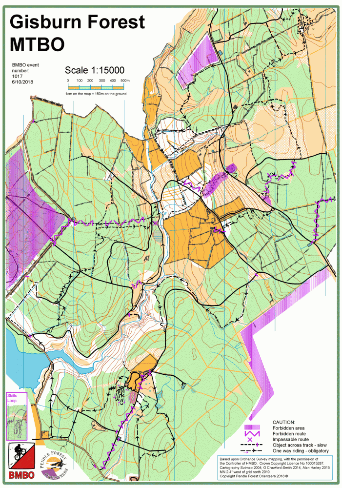
| Gisburn MTBO | Tosside | Gisburn Forest MTBO map. |
|
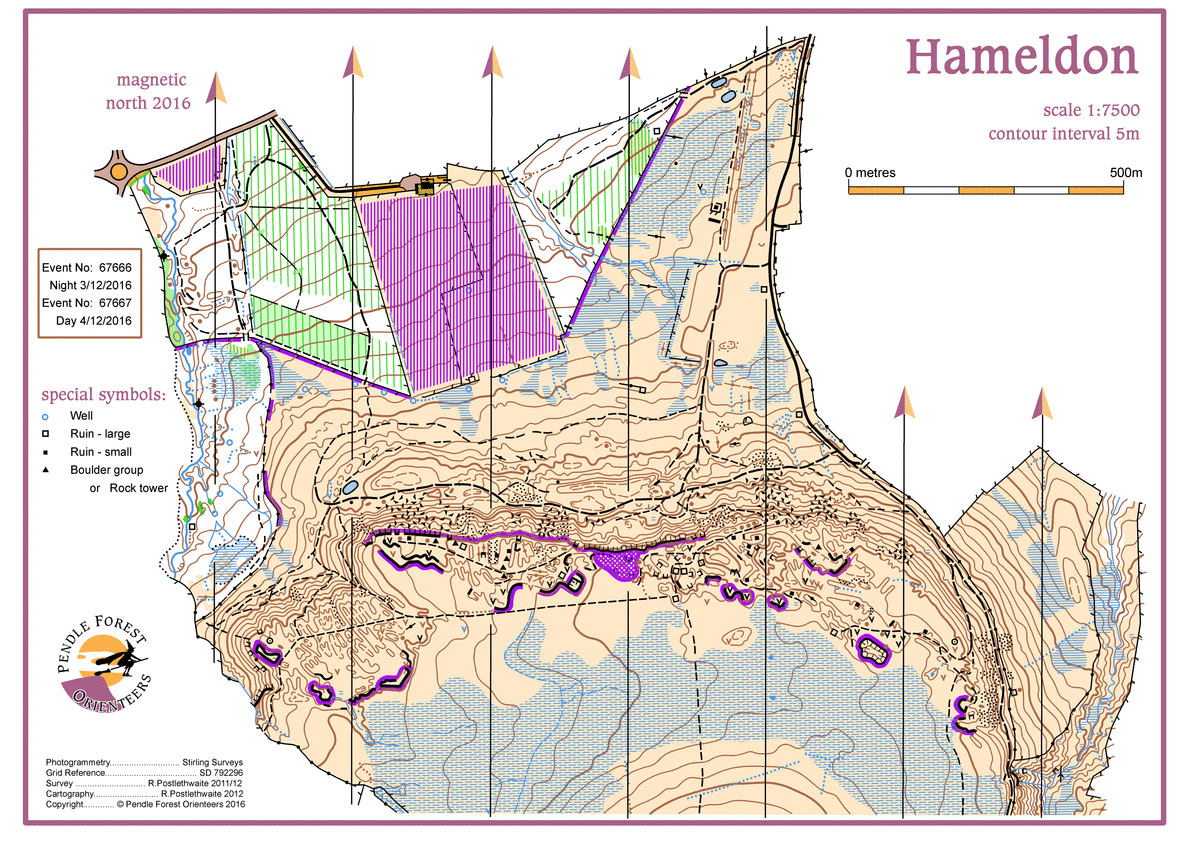
| Hameldon Hill (North) | Hapton, Burnley | Hameldon Hill & Woods (North) |
|
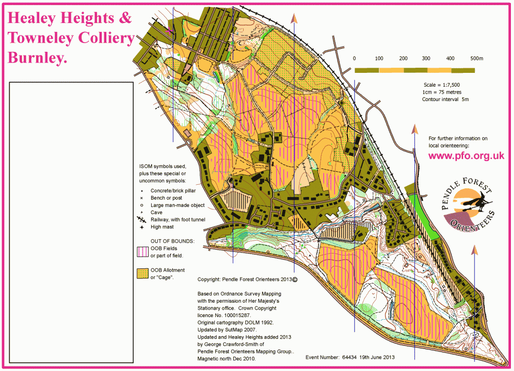
| Healey Heights and Towneley Colliery | Burnley | Healey Heights has been added to the Townley Colliery area map. |
|
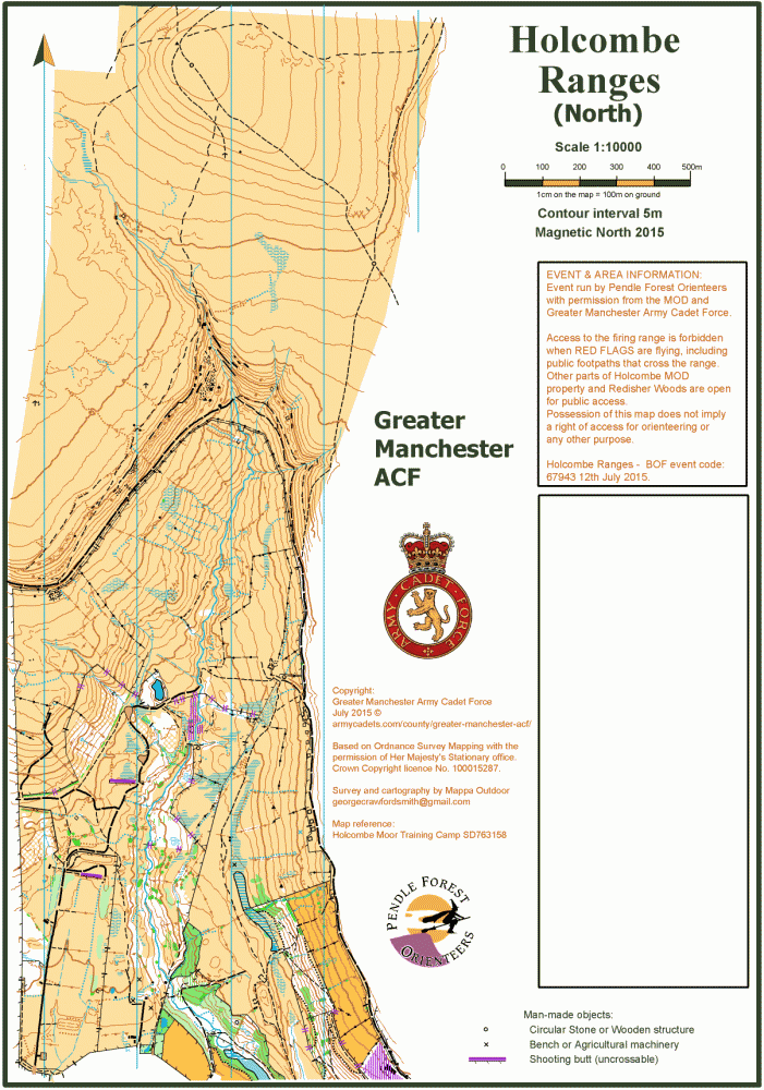
| Holcombe Ranges | Ramsbottom | Holcombe Ranges North part. |
|
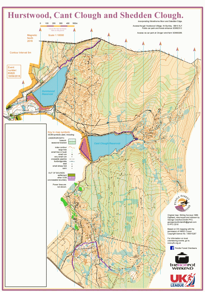
| Hurstwood | Hurstwood, Burnley | Hurstwood, near Burnley |
|
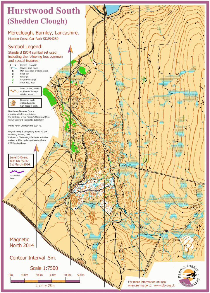
| Hurstwood South | Mereclough village, | Hurstwood South or Shedden Clough. |
|
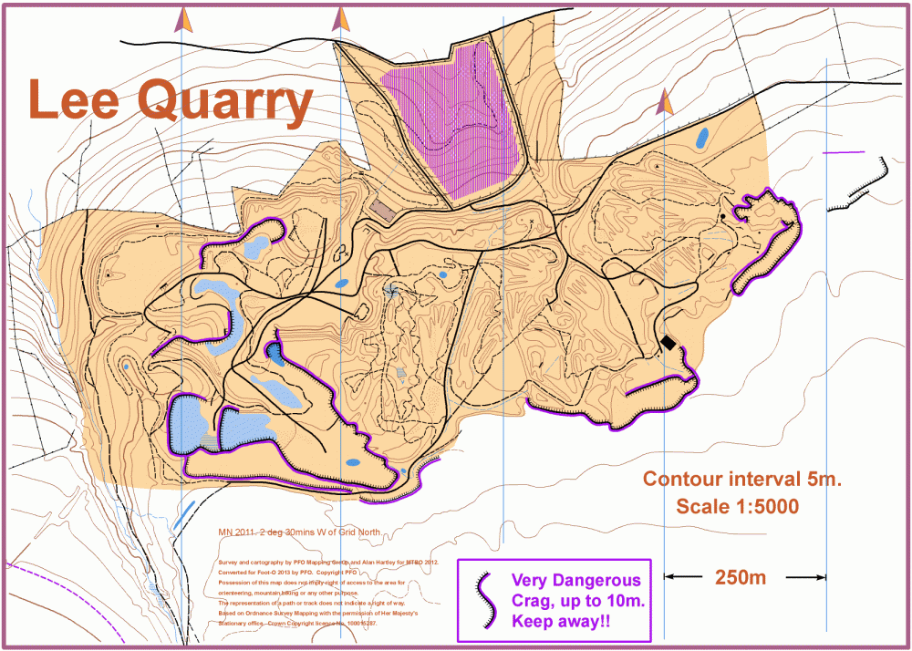
| Lee Quarry, Bacup | Bacup | Lee Quarry is a major venue for mountainbikers, with a lot of contour detail. |
|
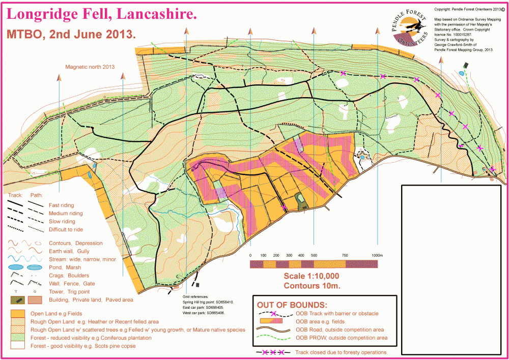
| Longridge Fell | Hurst Green | Longridge Fell MTBO Map Extract |
|
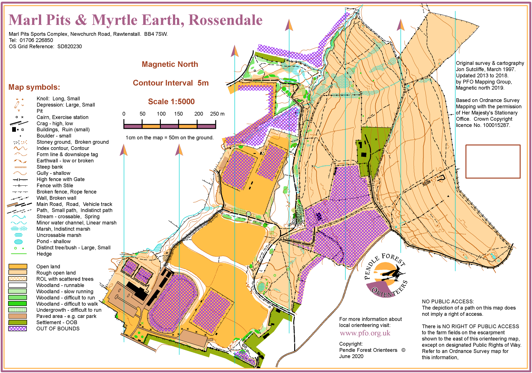
| Marl Pits | Rawtenstall | Marl Pits sports complex. |
|
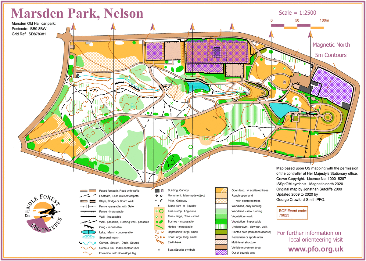
| Marsden Park, Nelson | Nelson, Lancashire | Marsden Park in Nelson is awell maintained runnable parkland with a large amount of contour detail. |
|
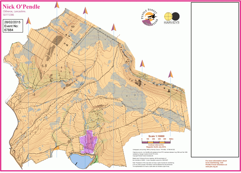
| Nick O’Pendle | Sabden | Open moorland. |
|
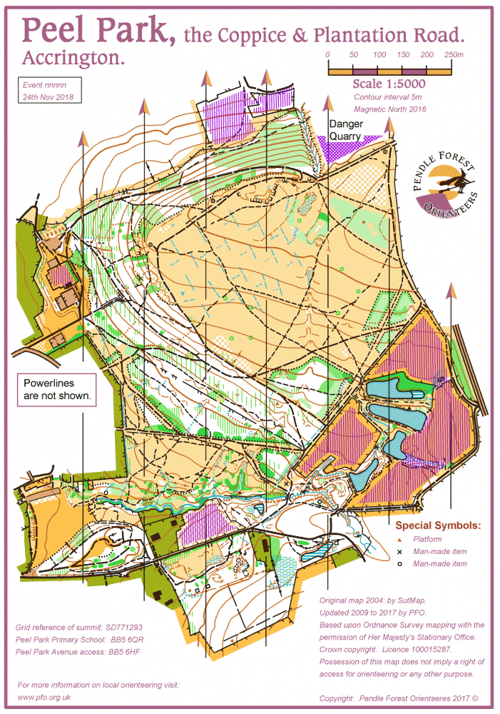
| Peel Park | Accrington | Peel Park & the Coppice. |
|
| Pendle Hill East | Barley, Lancashire | Pendle Hill East, including Ogden Clough, Fell Wood and Pendle Hill summit. |
|
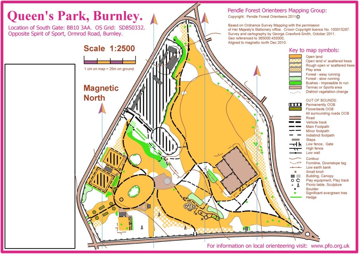
| Queen's Park, Burnley | Burnley | Classic parkland. Open and fast, with lots of features. |
|
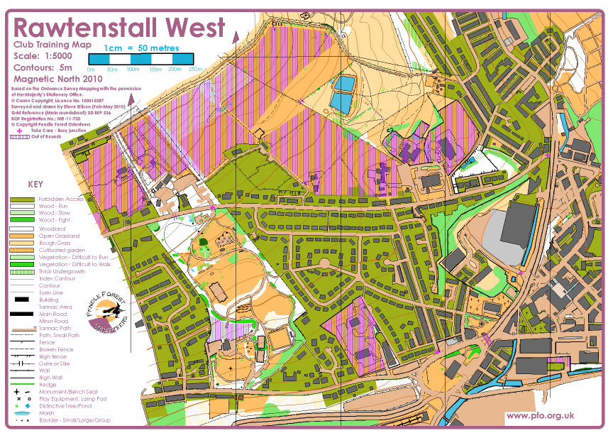
| Rawtenstall West | Rawtenstall | Rawtenstall Club Training Map; Mix of Urban, Park & Open Orienteering. |
|
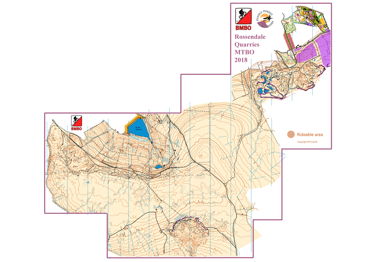
| Rossendale 3 Quarries | 3 linked quarries on the south side of Bacup, Rossendale. |
|
|
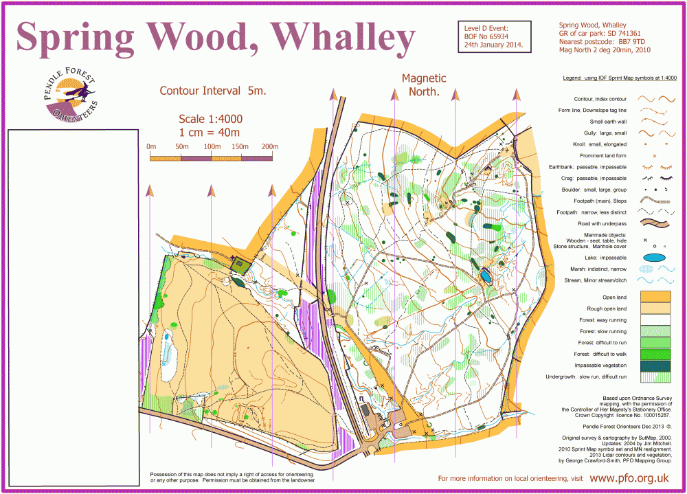
| Spring Wood, Whalley | Whalley, Lancashire | Spring Wood is an area of managed woodland near Whalley. |
|
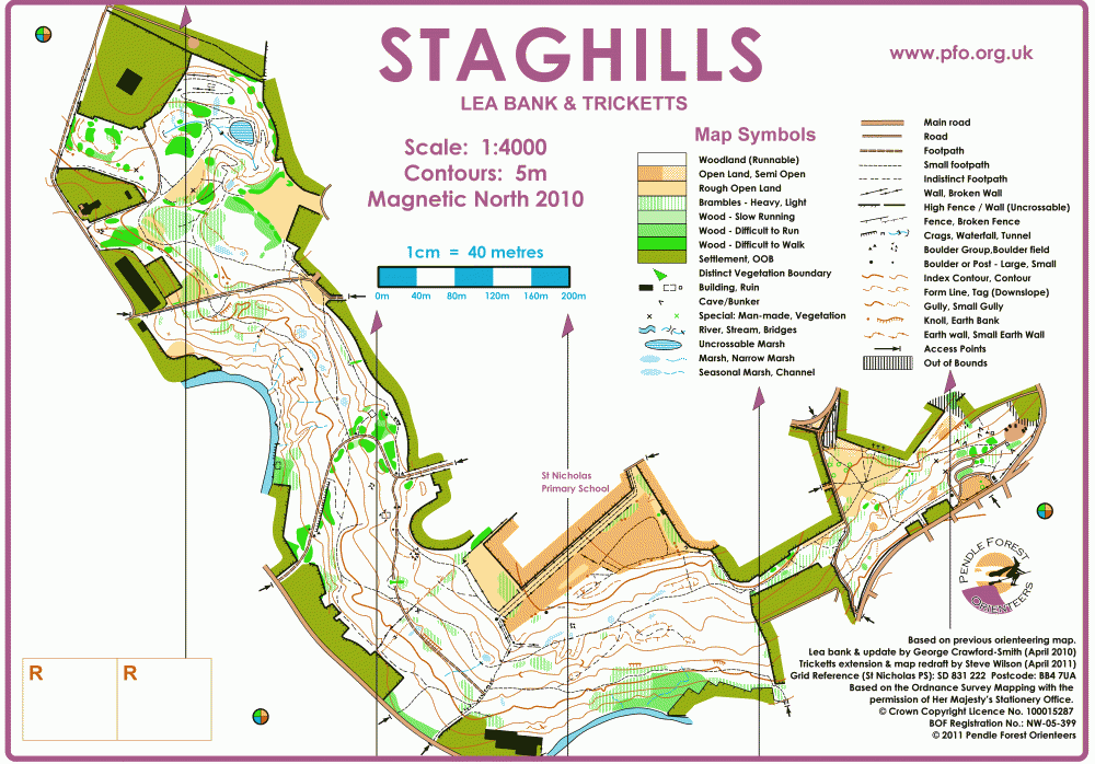
| Staghills | Newchurch in Rossendale | Staghills, Lea Bank and Tricketts woods. |
|
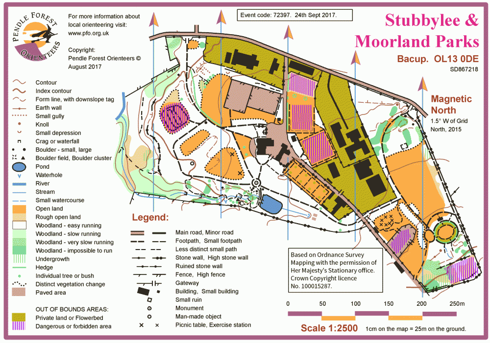
| Stubbylee and Moorland Parks | Bacup, Rossendale | Stubbylee & Moorland Parks map |
|
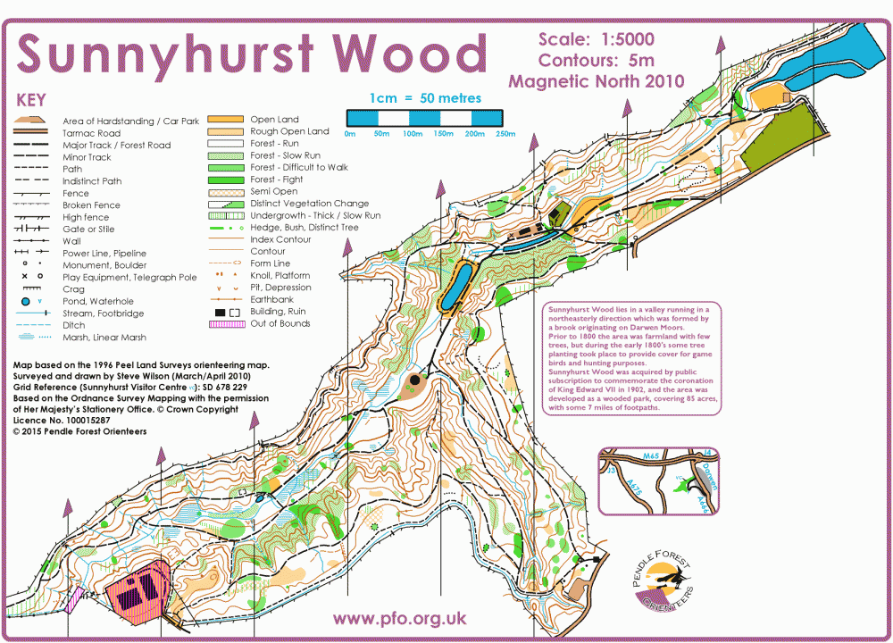
| Sunnyhurst Woods | Darwen | Sunnyhurst Woods, Darwen |
|
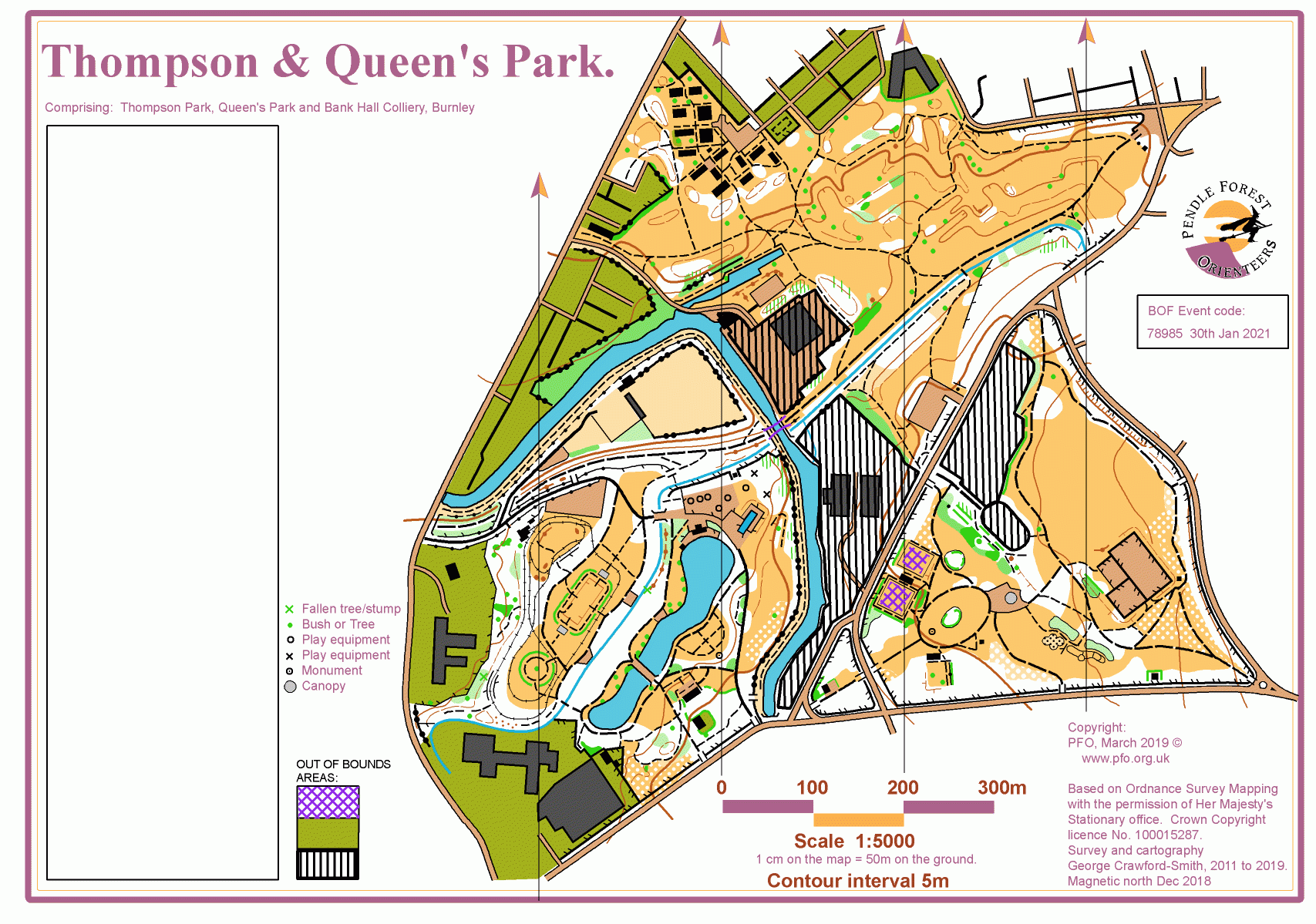
| Thompson & Queen's Parks and Bank Hall | Burnley | Parkland. adjoining landscaped colliery site and woodland. |
|
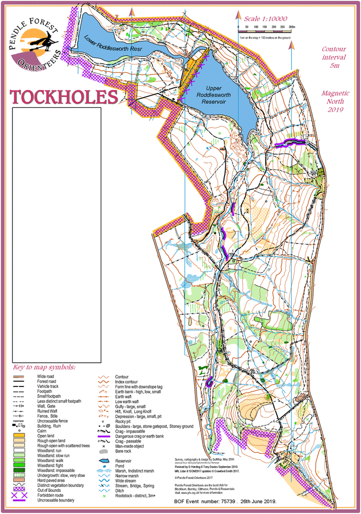
| Tockholes Woods | Blackburn | Mixed woodland reservoir catchment area. Excellent technical standard. Good runnable terrain at all times of year. |
|
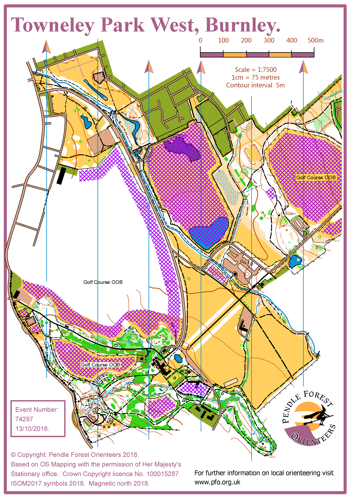
| Towneley Park | West and East parts of Towneley Park. |
|
|
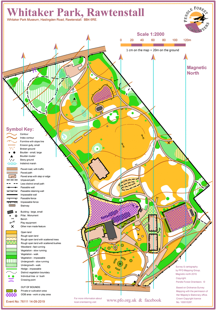
| Whitaker Park | Rawtenstall | Whitaker Park, Rawtenstall |
|
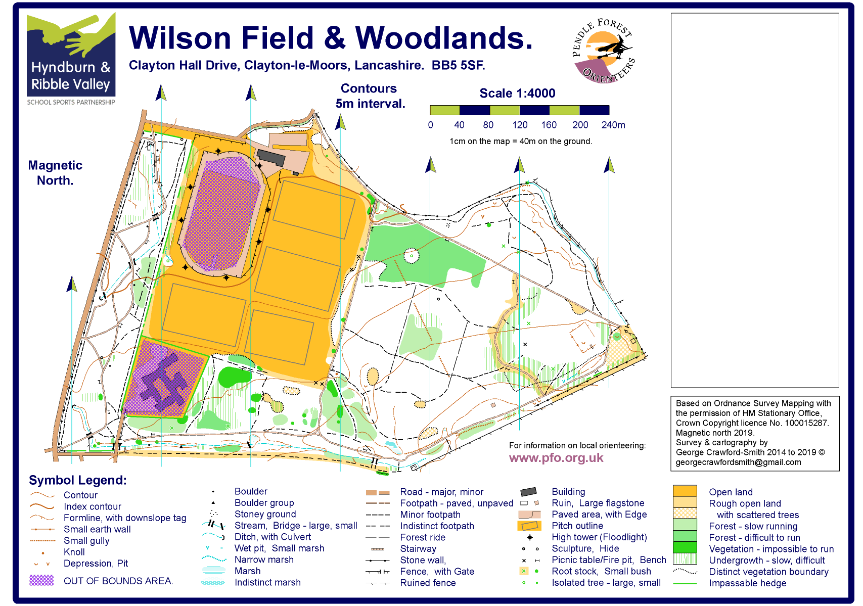
| Wilson Field | Clayton-le-Moors | Wilson Field, Clayton-le-Moors |
|
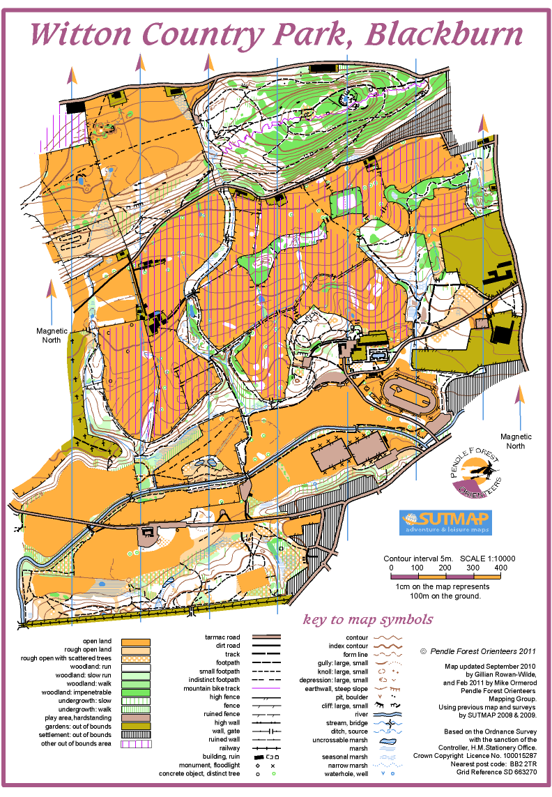
| Witton Park | Blackburn | Witton Park Country Park, Blackburn. |
|
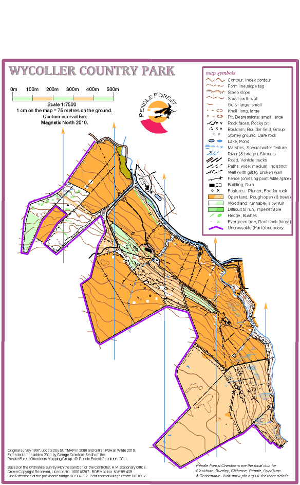
| Wycoller | Trawden | Wycoller Country Park |
|

Mapped Areas
All the areas we have mapped for orienteering. Select a flag to show its details.
Note: Possession or existence of a map does not imply right of access for orienteering or for any other purpose. Permission must be obtained from the landowner.